
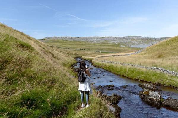
The best Yorkshire Dales hiking routes are not necessarily the ones with the highest summit. A walk across limestone pavement feels different from a riverside path, even when both fit into the same afternoon. This national park rewards walkers with dry-stone walls, waterfalls, open moorland and broad ridges overlooking green valleys.
For a satisfying day out, match the route to the ground underfoot as carefully as the mileage. These six walks range from gentle valley outings to demanding upland circuits.
Six Yorkshire Dales hiking routes worth planning around
Malham Cove, Janet’s Foss and Gordale Scar: limestone drama
For a concentrated introduction to Dales geology, start in Malham village. The National Park Authority’s Malham Landscape Trail is about 4.5 miles (7.2km) and brings together Janet’s Foss waterfall, Gordale Scar and the imposing limestone amphitheatre of Malham Cove. Allow roughly three hours, longer for photography and stops.
The scenery changes quickly: woodland gives way to sheer rock walls, then the patterned limestone pavement above the cove. Those blocks and deep fissures demand careful footing. Avoid treating a scramble through Gordale Scar as an essential shortcut; choose a signed walking route appropriate to conditions and your experience.
Malham Tarn: open landscapes without a summit push
Malham Tarn offers a quieter limestone-country walk. The National Trust’s archaeology circuit from Street Gate covers approximately 5.5 miles (8.8km), taking three to four hours across pastures, tracks and historic upland farming land. There’s one notably steep uphill stretch, and muddy ground is possible after rain.
For something shorter, the National Nature Reserve walk from Waterhouses is around 2 miles (3.2km), with boardwalk, woodland and grassy sections. Check the particular route before bringing a dog: restrictions differ between trails. Choose this area for views and wildlife rather than a strenuous ascent.
Whernside from Ribblehead: a proper upland day
Whernside changes the scale of the adventure. The National Park Authority describes a roughly 7-mile circular walk beginning near Ribblehead Viaduct and reaching Yorkshire’s highest summit. The railway arches provide a memorable opening, but the challenge is the elevation gain and exposed fell terrain.
Choose Whernside if you’re comfortable navigating beyond sheltered valleys and can handle a lengthy descent on slippery ground. Summit views depend on cloud and visibility. Wind on the ridge can feel much colder than it does beside the viaduct.
Aysgarth Falls: waterfalls with flexible distances
At Aysgarth Falls in Wensleydale, a National Park Authority woodland-and-waterfalls circuit is approximately 2.5km. The River Ure tumbles over three limestone ledges, while nearby Freeholders’ Wood offers a contrasting setting.
This area suits mixed-ability groups because shorter viewpoints and a separate Miles Without Stiles option are available. Do not assume every viewpoint is step-free: paths towards the lower falls include substantial steps. After heavy rain the falls can be spectacular, but keep back from slippery river edges.
Burnsall and the River Wharfe: slow walking done well
For easygoing Yorkshire Dales walks, begin at Burnsall in Wharfedale and follow the River Wharfe towards Loup Scar. The National Park Authority identifies a level, surfaced section of the Dales Way about 700 metres long as a Miles Without Stiles route. It makes a pleasant out-and-back outing without a demanding climb.
Kissing gates may be awkward for some mobility scooters, so accessible does not mean obstacle-free. Extend your walk only after checking a map and the terrain beyond this section. Burnsall works well when companions have different stamina levels.
Pen-y-ghent from Horton-in-Ribblesdale: a classic hill circuit
Pen-y-ghent is often a first taste of higher-level Dales hiking. The circuit from Horton-in-Ribblesdale combines a striking summit with views towards Hunt Pot and Hull Pot. Steep, rocky ground deserves more preparation than the route’s popularity might suggest.
Check an official map for the exact circuit, distance and conditions. The Yorkshire Three Peaks challenge is a separate, far longer undertaking; you needn’t tackle all three summits to enjoy this landscape. One well-chosen peak makes a rewarding adventure day.
Choose by terrain, not just distance
Two routes of similar length can feel completely different. Limestone pavement is uneven and fissured; river paths can be smooth but muddy; upland walking brings wind exposure, steep gradients and more demanding navigation. When comparing hiking Yorkshire options, check ascent, surfaces and available shelter alongside mileage.
For a first visit, Malham provides varied geology in one compact circuit. For an unhurried outing, choose Burnsall or the shorter Malham Tarn trail. If you want a substantial upland walk in the UK, Whernside or Pen-y-ghent provides higher ground without a multi-peak challenge.
Make the day work in real conditions
Imagine you’ve booked a weekend near Settle and the forecast changes to low cloud and strong hilltop wind. Instead of forcing a Whernside ascent, switch to a lower route near Malham or a woodland walk, provided local paths and water levels are safe. You may see more scenery than you would climbing into fog.
Carry a map or downloaded route, not just a signal-dependent app. Wear grippy footwear for wet limestone, take waterproof layers and pack water and food. Check daylight hours, transport, temporary path notices and the forecast before leaving. Follow the Countryside Code: control dogs around livestock, close gates and leave no litter.
A guide to day-hike essentials can help organise your kit, while a guide to UK hillwalking weather is useful before tackling an exposed ridge. For another kind of outing, consider scenic British countryside walks that stay closer to villages.
Frequently asked questions
What is the best Yorkshire Dales hike for a first-time visitor?
The Malham landscape circuit is a strong introduction if you’re comfortable with steps and uneven rock. It combines waterfalls, a gorge and Malham Cove without committing you to a remote summit. For a gentler experience, try Burnsall.
Are there easy Yorkshire Dales hiking routes?
Yes. Burnsall’s short riverside section and selected paths around Aysgarth Falls suit less strenuous walking. Check individual surfaces, steps and gates if accessibility is a priority.
When is the best time for hiking in the Yorkshire Dales?
Late spring through early autumn brings longer daylight hours, but good walking days occur year-round. Rain, wind and visibility matter more than the calendar for exposed routes. Limestone becomes slippery when wet.
Do I need navigation skills for Dales hiking?
Lower-level paths may be straightforward, but carry reliable route information. On Whernside, Pen-y-ghent and other exposed uplands, map and compass skills and the ability to turn back safely are valuable.
A landscape worth exploring at your own pace
The pleasure of the Dales lies in their variety. One day might cross limestone above Malham; another could follow the Wharfe or climb towards a broad felltop horizon. Choose a route that fits the weather and your group’s abilities, and the walking becomes the highlight rather than a race to finish.