
Offa’s Dyke Path is a walk of contrasts. One morning you might follow a wooded river valley; the next, you could be high on a windswept ridge with England on one side and Wales on the other. Unlike a coastal trail, its rewards are not tied to the sea. Unlike a mountain-only trek, its character changes between historic towns, farmland and open hills.
This Offa’s Dyke Path guide explains how to plan a multi-day trip, from realistic stages to overnight stops, transport and the stretches where careful preparation matters most.
What to expect from the route
The National Trail runs approximately 177 miles (285km), from Sedbury Cliffs near Chepstow to Prestatyn on the north Wales coast. It broadly follows the England–Wales border, crossing it repeatedly, although it does not stay beside the ancient earthwork throughout. The dyke dates from the eighth century and is associated with King Offa of Mercia.
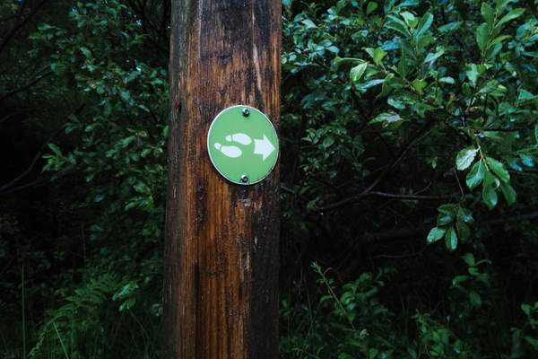
Allow roughly two weeks for the full walk. A 12–16-day itinerary gives you room to adjust daily mileage for hills, fitness and sightseeing. You can walk in either direction; National Trail acorn signs mark the route both ways.
For those comparing long distance walks in Wales, the variety is the attraction: Wye Valley woodland, Black Mountains ridges, steep Shropshire hills and the Clwydian Range before the sea.
Planning Offa’s Dyke Path stages
There is no single correct set of offas dyke path stages. Some published sections exceed 17 miles and include serious climbing. Build an itinerary around both elevation and available beds, rather than choosing an identical mileage target every day.
South: Sedbury Cliffs to Hay-on-Wye
From the Severn estuary, the route crosses Wye Valley country to Monmouth and continues through Monmouthshire towards Pandy. Official sections from Sedbury Cliffs to Monmouth and Monmouth to Pandy measure approximately 17.5 and 16.75 miles respectively. Both can be long days with luggage.
Pandy to Hay-on-Wye is especially memorable. The path climbs onto Hatterrall Ridge in the Black Mountains, reaching roughly 700 metres. It offers expansive views in good weather, but wind, rain and mist can make navigation and pacing harder. Investigate accommodation-based ways of splitting this section if a full ridge day is too much.
Middle: Hay-on-Wye to the Shropshire hills
From Hay-on-Wye, the route passes through Kington towards Knighton, which sits near the halfway point. Knighton makes sense for a rest day, resupply or start of a shorter holiday.
Do not assume the hardest ground is behind you. North of Knighton, repeated steep climbs and descents known as the Shropshire switchbacks can feel tougher than one sustained ascent. This is a good place to plan shorter walking days.
North: river plains to Prestatyn
The route eventually reaches gentler terrain around the Severn Valley and Montgomeryshire Canal, then continues through the borderlands towards Chirk and Llangollen. The Clwydian hills provide a final upland challenge before the descent to Prestatyn and the Irish Sea.
Mark likely overnight stops on a current route map before setting daily distances. A shorter day around the midpoint offers breathing room if an earlier stage runs long.
Accommodation, meals and resupply
The challenge with this Wales border walk is that accommodation may be off the path, with limited choices in rural areas. Inns, guesthouses and campsites vary by location and season. Reserve ahead during popular walking months, and check the actual distance between the route and your accommodation.
Ask hosts about early breakfasts, packed lunches and luggage-transfer options. A two-mile detour at the end of a hilly day can make a major difference to your energy and arrival time.
For example, someone walking Pandy to Hay-on-Wye should not expect a convenient café on Hatterrall Ridge. Carry the food and water you need, know where you will descend, and check the forecast before committing to the exposed stretch.
Transport and choosing a shorter trip
Chepstow has rail connections, with Sedbury Cliffs a separate walk from town. Prestatyn has a railway station near the northern end, and Knighton offers another useful rail access point. Smaller settlements may have infrequent buses or no convenient service at all.
Check timetables for the exact date, especially Sundays and bank holidays. Book any essential taxi transfer in advance rather than assuming one will be available at the trailhead.
If you have a week, consider a middle section around Knighton or a northern section around Llangollen and the Clwydian Range. Settle your journey home before booking beds: an attractive finishing village is less practical without reliable onward transport.
Terrain, navigation and what to pack
Expect field paths, woodland tracks, grassy ridges, roads and occasionally muddy or uneven ground. The trail is waymarked, but you still need navigation skills. Carry current mapping, an offline route and a charged power bank. A guide to reading walking maps is useful preparation for less obvious junctions.
Bring waterproofs, a warm layer, comfortable worn-in boots or walking shoes, spare socks and blister supplies. Wind chill and visibility on a ridge can be very different from conditions forecast in the nearest town. Pack enough food between confirmed resupply points.
Spring to early autumn is the main walking season, though the trail remains open year-round. Longer daylight helps with strenuous stages. Check current weather and official diversion notices before setting out, and follow signed alternatives. A multi-day hiking packing list can help you trim unnecessary weight if you are sleeping indoors.
Frequently asked questions
How difficult is Offa’s Dyke Path?
It is a challenging long-distance trail, not a technical climb. The Black Mountains, South Shropshire switchbacks and Clwydian hills demand stamina, especially in poor weather.
How long does the full walk take?
About two weeks is typical. Faster walkers may take fewer days, while 15 or 16 days allow gentler pacing and more time in the border towns.
Can you walk only one section?
Yes. Choose a stretch with workable accommodation and public transport. Knighton is particularly useful for a partial itinerary.
Should you walk northbound or southbound?
Both are signed. Northbound offers a finish at the sea; southbound may suit your transport better. Let your logistics decide.
A border walk worth taking slowly
The best offas dyke walk is not necessarily the fastest. Give exposed ridges some flexibility, linger in the market towns and leave room for weather changes. With sensible stages, booked beds and dependable navigation, this journey feels much richer than a line drawn between two coasts. For future adventures, compare other long-distance walks in Wales to find a route with a different rhythm.